I have been thinking about a walkable map of the Mediterranean Rim since 2010. I was preparing to share an introduction to 1 and 2 Thessalonians with church leaders in Rwanda. How can I bring to life the travels of Paul in Acts and the words he uses in these letters? For example, "So when we could stand it no longer, we thought it best to be left in Athens. We sent Timothy... to strengthen and encourage you..." (1 Thessalonians 3:1-2). If we could actually walk the map, we could, to some degree, experience Paul's travels.
Are there giant maps of the Mediterranean Rim available?
Is it possible to professionally produce such a map?
How could Rwandans reproduce this map or will they be dependent on me?
In a discussion with my friend, Neal Windham, we came to the conclusion it might be possible to project the map onto tarps and then trace it. Tarps are available in Rwanda. RC has a projector in Rwanda that Theophile can use. If the Rwandan church leaders create the map, they are also learning the geography (similar to the Bible college assignment for students to create Bible maps).
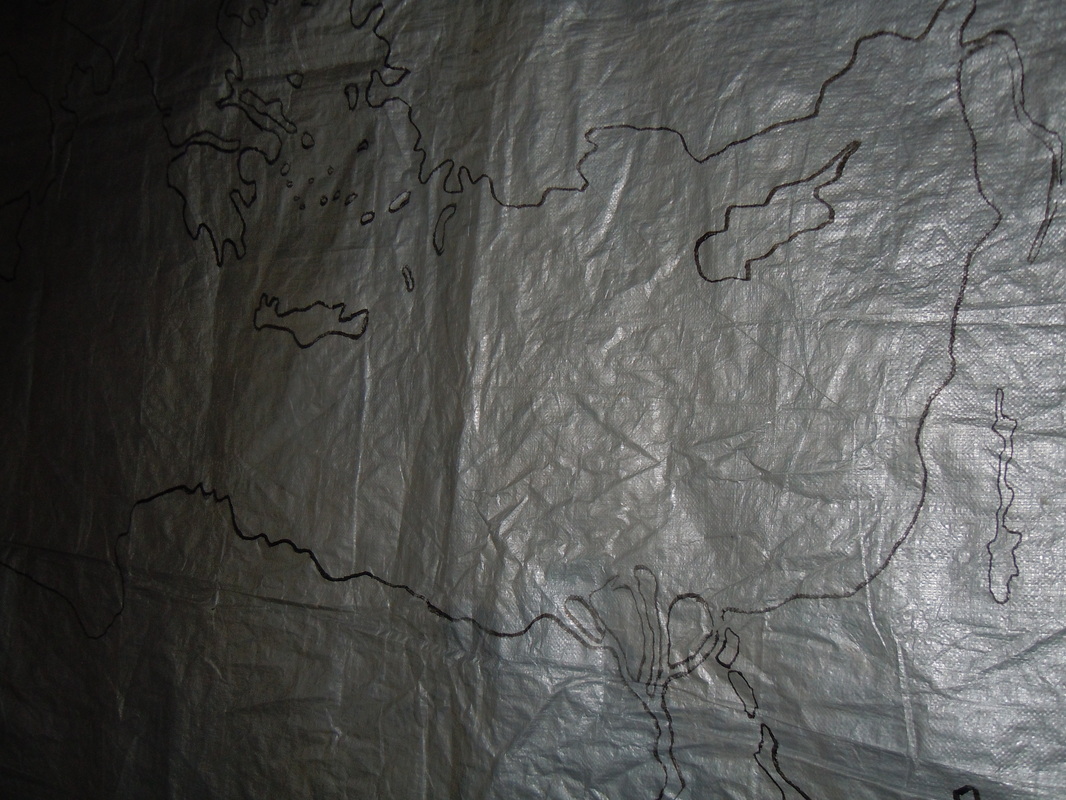
So, yesterday we began the experiment. We were able to trace a reasonable map on a tarp (9' 8" x 12' 5"). Next trip we will plan to trace one map covering four tarps (24' 10" x 19' 4"). We can velcro the edge of the tarps together and then velcro on any cities, towns, rivers, etc. in any language. We will be able to walk this map outside or in a church building.
Thank you Jesus!
Excited in Rwanda,
Frank
Are there giant maps of the Mediterranean Rim available?
Is it possible to professionally produce such a map?
How could Rwandans reproduce this map or will they be dependent on me?
In a discussion with my friend, Neal Windham, we came to the conclusion it might be possible to project the map onto tarps and then trace it. Tarps are available in Rwanda. RC has a projector in Rwanda that Theophile can use. If the Rwandan church leaders create the map, they are also learning the geography (similar to the Bible college assignment for students to create Bible maps).
So, yesterday we began the experiment. We were able to trace a reasonable map on a tarp (9' 8" x 12' 5"). Next trip we will plan to trace one map covering four tarps (24' 10" x 19' 4"). We can velcro the edge of the tarps together and then velcro on any cities, towns, rivers, etc. in any language. We will be able to walk this map outside or in a church building.
Thank you Jesus!
Excited in Rwanda,
Frank
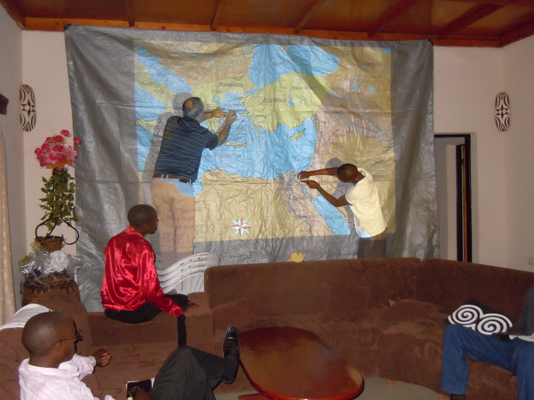 |  |
| Frank and Augustin trace the shorelines to create a Mediterranean map. | This is going to work! |
 RSS Feed